Hello everyone! We are the FDDI Secretariat.
We operate a drone school in Japan and would like to inquire if there is demand for our highly popular Komatsu Certified Drone Survey Practice Course internationally.
If there is interest, we are considering partnerships with overseas drone schools or offering the course online.
We would be delighted if those interested could contact us via email.(info.f@fddi.jp)
Also, please feel free to share your thoughts and opinions with us. Below are the details of the Komatsu Certified Drone Survey Practice Course that we are currently offering in Japan.
Course Features
- Learn Komatsu’s 3D surveying know-how, cultivated at over 4,000 construction sites in Japan, in a short period.
- Course for those who want to practice surveying technology on-site.
- Recommended for surveying companies entering public and private 3D surveying sectors.
- Suitable for companies considering i-Construction implementation.
6 Key Points
POINT
01
Komatsu-developed and certified curriculum for practical 3D surveying in public and private sectors.
POINT
02
Provides 3D surveying know-how from over 4,000 domestic construction sites.
POINT
03
Hands-on training simulating real-world tasks such as initial and as-built surveys, and private land development.
POINT
04
Realistic training fields resembling actual survey sites like riverbeds and roads.
POINT
05
Systematic acquisition of analysis techniques to generate 3D data from drone-captured photos.
Reasons to Choose This Cours
01.Japan’s first Komatsu-certified drone survey practical course.
Komatsu, promoting smart construction, has condensed its 3D surveying know-how, gained from over 4,000 construction sites across Japan, into both classroom learning and practical training.
02.Realistic training fields close to actual survey sites.
Creating a realistic training field setting similar to actual surveying sites such as riverbanks and roads and condensing the accumulated 3D surveying expertise into classroom lectures and practical exercises.
03.Comprehensive support for immediate implementation in surveying tasks.
Covering the entire process from creating construction plans, conducting groundbreaking surveys, as-built surveys, and practical training in private construction, all the way to preparing i-Construction submission documents.
04.Optimal course curriculum tailored to the participant’s level.
Providing an optimal course curriculum tailored to participants’ drone surveying experience
Komatsu’s Recommendation
****Recommendation for Surveying Companies Entering the Public and Private 3D Surveying Sectors****
We highly recommend this Drone Surveying Practical Course to surveying companies entering the public and private 3D surveying sectors. In 2018, numerous i-Construction projects were initiated at both national and prefectural levels. This course, developed by Komatsu based on the expertise of Smart Construction*, is designed to facilitate the practical entry of surveying companies into public and private 3D surveying.
Completing this course will provide participants with a systematic understanding of the entire process of 3D surveying in i-Construction projects for public surveys. For private surveys, participants will gain proficiency in creating 3D surveying deliverables.
Komatsu Smart Construction Promotion Headquarters
Leader: Kazuya Murakami
*Smart Construction is Komatsu’s advocated solution for surveying, design, and construction, integrating everything on the field organically through ICT to create a safe and highly productive “future site.” It is positioned as a core solution within the i-Construction initiative promoted by the Ministry of Land, Infrastructure, Transport, and Tourism.
Significance of 3D Surveying
Drone and LS surveying are conducted to grasp detailed earth volume calculations, which is the first stage of ‘Smart Construction.’
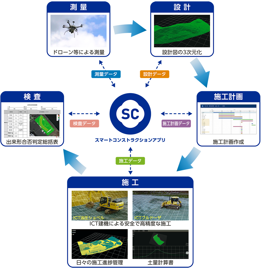
“Source: Komatsu Ltd. ‘Significance of 3D Surveying'”
Workflow of Drone Surveying
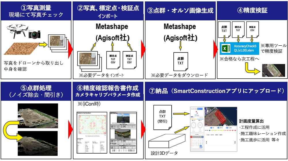
“Source: Komatsu Ltd. ‘Significance of 3D Surveying'”
Learn Drone Surveying Know-how by Task in Komatsu Survey Course
You’ll learn Komatsu’s accumulated expertise from 4,000 sites through a combination of classroom sessions and hands-on practice, focusing on specific tasks and iterating between theory and practical application.
01.Basic knowledge of i-Construction
02.Construction planning to shooting methods
03.Use of Metashape (Agisoft) software
04.Final deliverable creation method
05.Key points in as-built surveys
06.Points for setting ground control points and camera settings for photogrammetry
We’ll impart exclusive, practical knowledge that can only be learned at our school, ensuring that you gain skills that are directly applicable in real-world scenarios!
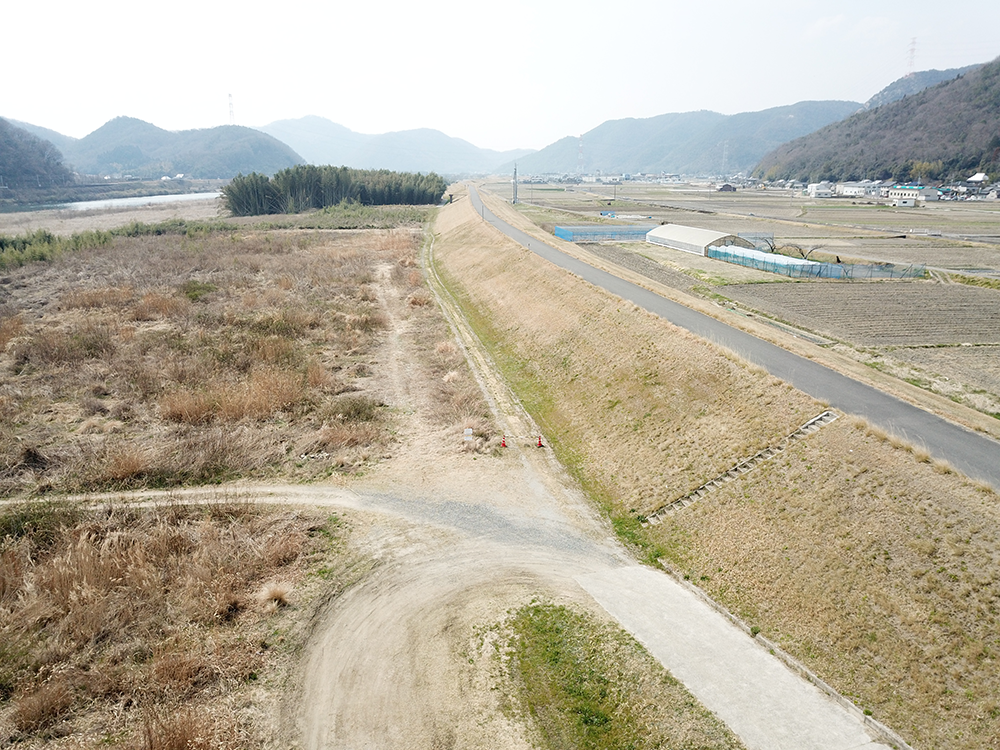
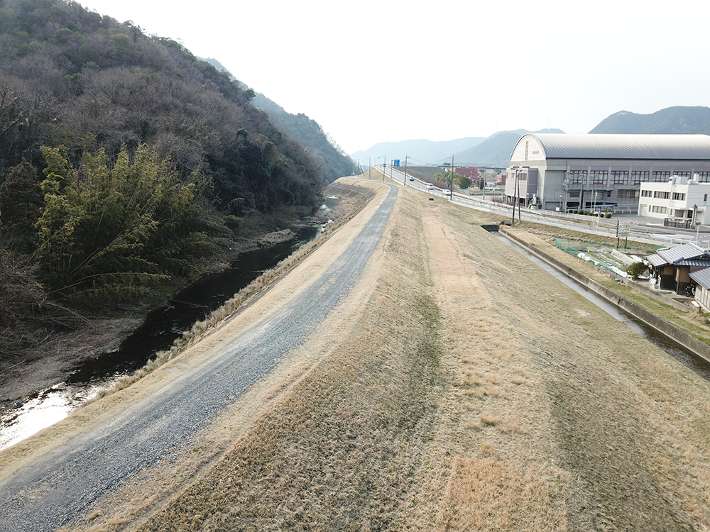
Training Environment
Nine realistic training fields in Wake Town, Okayama Prefecture, selected by Komatsu.
These fields resemble actual survey sites like riverbeds and roads, providing necessary skills for real-world conditions.
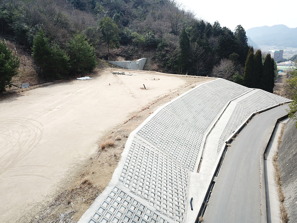
- Sufficient Area
- Safe Environment for Flight
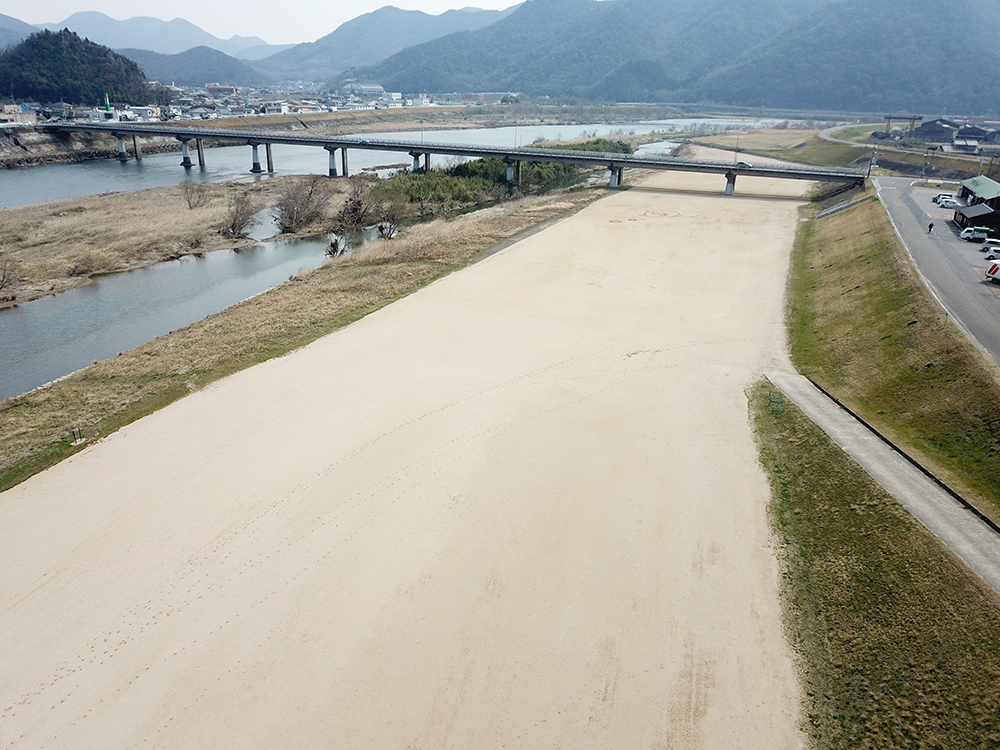
- Adequate Space
- Realistic Environment (Riverbank for example)
- ・十分な面積 ・交通量が少ない
- ・実際の現場に近い(河川堤防)
- Adequate Space
- Low Traffic Volume
- Realistic Environment (Riverbank, for instance)
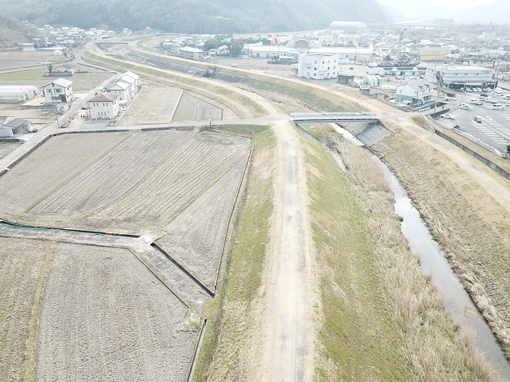
- Similar to a Road Surveying Site
- Suitable Practice Slopes Available

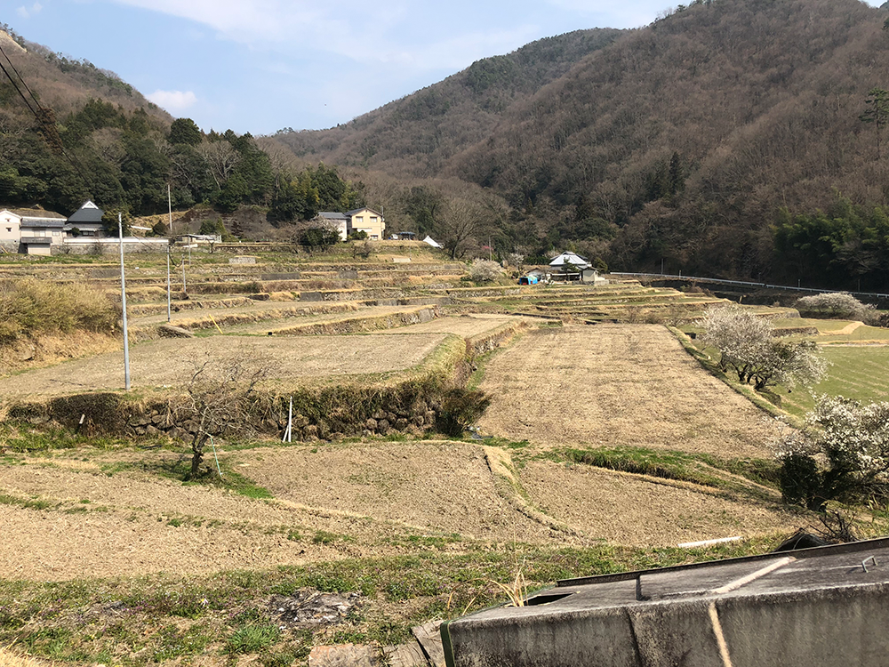
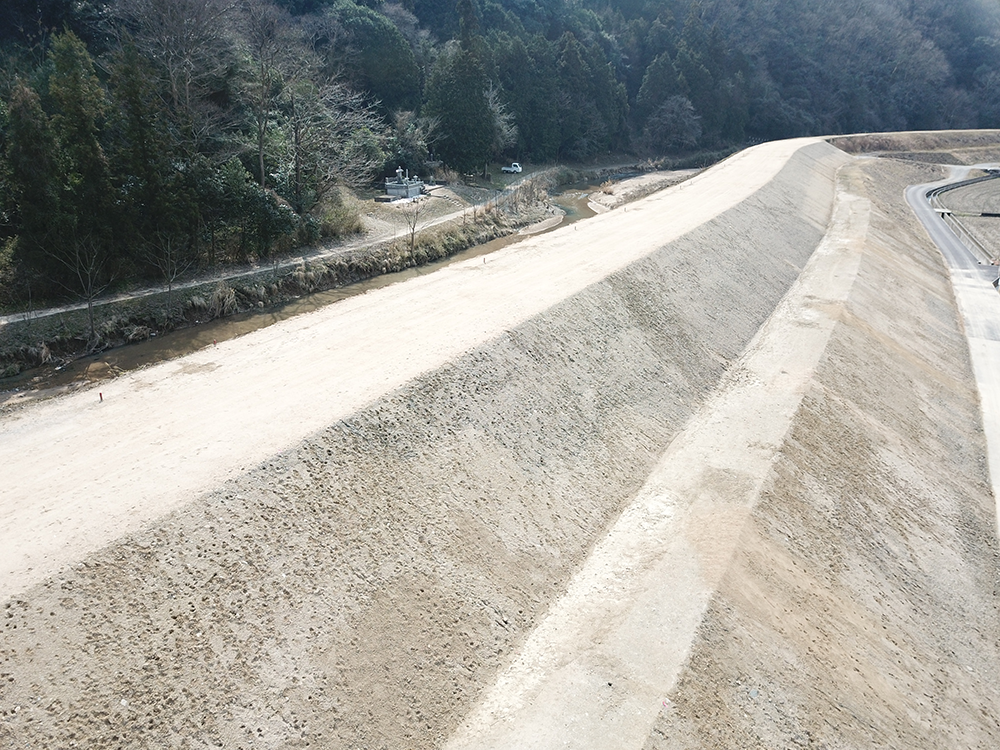

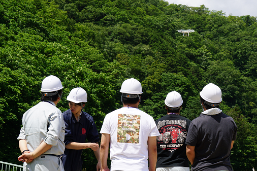
Training Scenes
Our school conducts lectures and practical training on drone surveying using fields close to actual survey sites.
Media Coverage
Our Komatsu Certified Drone Survey Practical Course was featured on OHK Prime News, highlighting the growing interest in 3D surveying using drones.